Physical Geography Research Methods
Physical Geography Sampling
Because it is impossible to measure everything everywhere at the same time, researchers sample. Sampling in physical geography is of the utmost importance in order to limit the amount of information that you collect, and so that you are careful that your sample is representative of the whole population. Sampling is based on three principals:
- The sample is the limited number of measurements that you make.
- The population is the total number of measurements that you might take.
- A totally representative sample is everything you need to know about the population.
For example, weather precipitation stations are located at specific locations across the country. The readings from each station are then statistically interpolated to give a picture of a large region. The same techniques can be done for soil and stream sampling. There are three types of samplying in physical geography:
- Random sampling is used where the study area is uniform. For example, in a flat, grassy field you can assume that the environmental conditions do not change within the area so it doesn’t matter where within the area you take your samples from. Random sampling should be free from bias, but it is difficult to obtain a representative sample. The number of samples taken is important.
- Systematic sampling is used when the study area includes an environmental gradient. You would sample along a line and sample points should be evenly spaced or distributed. Systematic sampling is quick and easy to do, but you must be careful not to miss variation. The number of samples that you take (the sampling size) is important.
- Stratified sampling is used when the study area includes significantly different parts or subsets. In an investigation into the effect of stream ordering on discharge, a stratified sample would be to choose sites where the two river segments of the same order join. Stratified sampling overcomes the problem with missing variation that might arise with systematic sampling. It is, however, difficult to get background data to allow you to apply stratified sampling appropriately.
Soil Science Research Methods
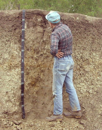
Soil testing is done by taking soil samples from different locations of the soil horizons. The soil samples are then taken to a lab for further analysis of the content of moisture, minerals, organic matter and air in the soil.
Hydrology Research Methods
Hydrology is the study of the movement, distribution and quality of water on Earth and other planets, including the hydrologic cycle, water resources and environmental watershed sustainability. A practitioner of hydrology is a hydrologist, working within the fields of earth or environmental science, physical geography, geology or civil and environmental engineering. Hydrogogy research makes extensive use of modelling to create conceptual representations of the different parts of the hydrologic cycle.
Climatology
Climatology is the study of climate, scientifically defined as weather conditions averaged over a period of time. Weather monitoring stations collect information for decades about temperature; wind velocity and direction; moisture concentration in the air; and precipitation, and indicate a specific climatic condition at a specific part of Earth.
Statistics in Geography
Statistical techniques and procedures are applied in all fields of academic research; wherever data are collected and summarized or wherever any numerical information is analyzed or research is conducted, statistics are needed for sound analysis and interpretation of results.
Geographers use statistics in numerous ways:
- To describe and summarize spatial data
- To make generalizations concerning complex spatial patterns
- To estimate the probability of outcomes for an event at a given location
- To use samples of geographic data to infer characteristics for a larger set of geographic data (population)
- To determine if the magnitude or frequency of some phenomenon differs from one location to another
- To learn whether an actual spatial pattern matches some expected pattern
Attributions
- Figure 1. Soil examined from a scar made by excavator. Source: Soil Sci by Paleorthid (http://en.wikipedia.org/wiki/File:Soil_sci.jpg) is in the public domain
