Lab 11: Environmental Controls on Biogeography
Gillian Krezoski
Biogeography is the science that attempts to document and understand spatial patterns in biodiversity. There are many biotic (living) factors that determine where biotas (e.g., assemblages of plants, animals) live, including competition and predation, as well as abiotic (environmental) conditions like fire and soil type. In this lab we will examine two major abiotic conditions that have a strong impact on what type of plant and animal species live where, worldwide: climate and topography. Species adapt and survive based on these factors or die out if challenges created by these conditions become too hard to overcome.
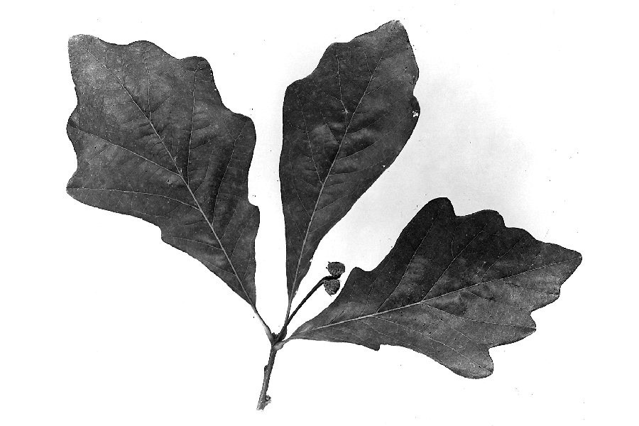
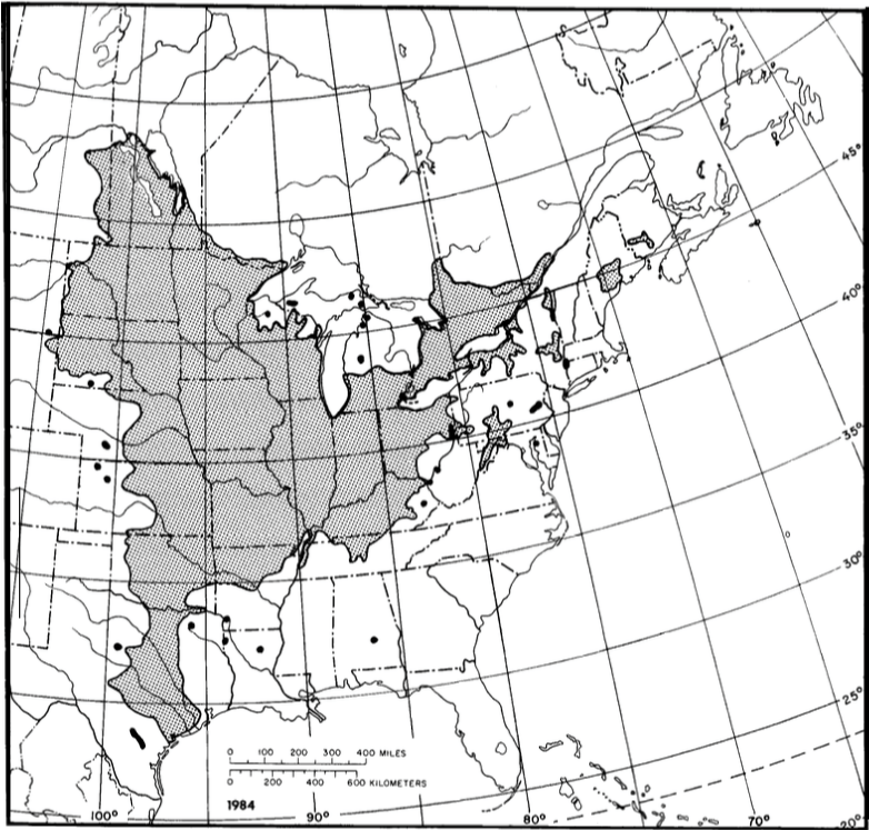
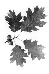
In this lab you will examine the geographic distribution of nine oak (Quercus) species in North America. Oaks all produce acorns, and are grouped into two general categories based on leaf shapes (amongst other things): lobed oak species are considered members of the white oak group, whereas serrated (pointy) leaf shapes are considered black oak group members. There are at least 90 species of oaks in North America, alone. Each have developed traits to ensure successful survival in differing abiotic conditions within their local environments. Based on your findings, you will answer several discussion questions designed to draw a link between environmental conditions and oak species adaptations to living in those areas.
Learning Objectives
After completion of this lab, you will be able to
- Collate observations and conclusions from several datasets.
- Begin to understand how climate and topography create different biogeographic zones.
- Analyze spatial data to determine abiotic impacts on oak tree diversity in North America.
Pre-Readings
In order to complete this lab, some background information on biogeography, Quercus species and climate maps are required. The United States Department of Agriculture has a comprehensive handbook covering multiple species, including Quercus. You will see portions of this text in this lab, and it can be explored further in Silvics of North America, Volume 2 (scroll to Quercus).
Abiotic Factors and How They Can Impact Tree Growth
Abiotic factors are non-living components of the environment that influence how and where organisms populate. These factors include components such as precipitation, sunlight and temperature (latitude), topography (altitude), nutrients and soils.
A good summary of how abiotic factors influence deciduous versus evergreen trees can be found in Smith (1993). Read this article or the summary provided by your instructor.
Water
Water is a fundamental abiotic factor regulating life as we know it on Earth. Plants need water to grow – even in deserts. Plant growth habits can be impacted by abundance of water, nutrients and sunlight, with areas that receive more of each often seeing taller plant growth.
Sunlight and Temperature
The sun drives the Earth’s climate. The sun is a major source of energy and thus also the primary driver of life on Earth. The sun provides energy to heat the planet (thus making the planet habitable) as well as the energy source used for photosynthesis by the base of our planet’s food chain. The sun’s energy heats the atmosphere, creating winds, influencing evaporation and precipitation, and driving atmospheric circulation. Climate is an important long-term environmental factor to which species adapt and is often categorized using temperature and precipitation.
Depending on where a plant is living in the world, adaptations can differ. For example, in areas where the sunlight is strong and drives much evapotranspiration, plants have adapted to have small to no leaves in order to conserve water (e.g. cacti). Often leaves have a waxy coating that also prevent water loss.
In areas that are more temperate (temperatures are more moderate and there is more precipitation), leaves are larger to take advantage of the limited but bountiful photosynthetic environment. Often temperate locations are at at a higher latitude and there is a portion of the year with much less sunlight (e.g. winter), where photosynthesis takes too much energy out of plant metabolism. In these places, trees lose their leaves seasonally (deciduous) and go dormant, conserving their energy and water for sunnier times. In areas where trees experience little to no seasonal fluctuations due to a mild climate and consistent rainfall, or where they experience harsh survival conditions and cannot spare the energy to regrow new leaves every year, trees remain evergreen (e.g. conifers) (Smith, 1993).
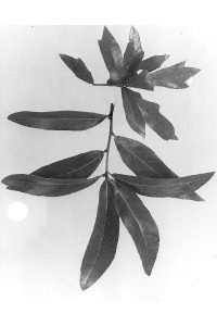
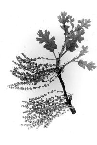
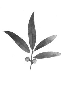
Most oak species are known for their lobe or serrated leaf shapes. The shape is often controlled by sunlight and precipitation – oaks that receive too much sunlight and less precipitation can minimize their gas exchange areas and narrow their margins to conserve water, versus areas that receive ideal sunlight and precipitation – leaves can be larger, wider and can support abundant gas exchange.
Oak species are relatively shade-intolerant (meaning they prefer full sunlight conditions) hardwoods. Often they rely on fire to eliminate competition from more shade-tolerant species. Studies on the history of humans and oak species over thousands of years can be explored further (outside of this lab) in Pellat and Gedalof (2014).
Topographic Conditions
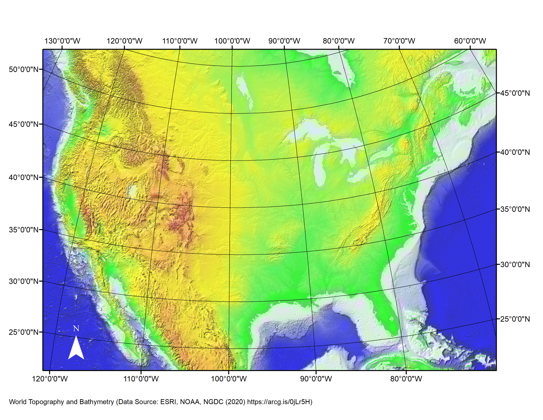
Also known as surface roughness, topography can also impact climatic conditions. Higher elevations, are colder due to lower atmospheric pressure and gas concentrations (thinner air) at higher elevation, where heat cannot be trapped as easily. Species living in higher versus lower elevations must be adapted to lower temperatures, prolonged freezing, and potentially lower oxygen levels from low atmospheric pressures at higher elevations, as well as poorer soil and nutrient cycling. Mountains also create orographic lift and rain shadows, producing regionally wetter (windward-side) or drier (lee-side) climate conditions.
Soils and Nutrients
Soils themselves provide basic vitamins and minerals for plant life to survive and thrive. Soils differ from place to place, based on parent rock, climate (temperature and precipitation) and organic decomposition rates. Carbon dioxide (CO2) is an important component of the photosynthesis process for plants, with Oxygen (O2) being a byproduct.
Biomes and Global Climate Zones
The world is divided into biomes, characterized by abiotic conditions that support particular habitats (Figure 11.1).
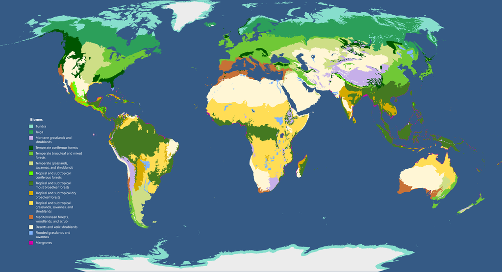
For more information on biomes, visit the online exhibit of Earth’s biomes at the University of California Museum of Paleontology.
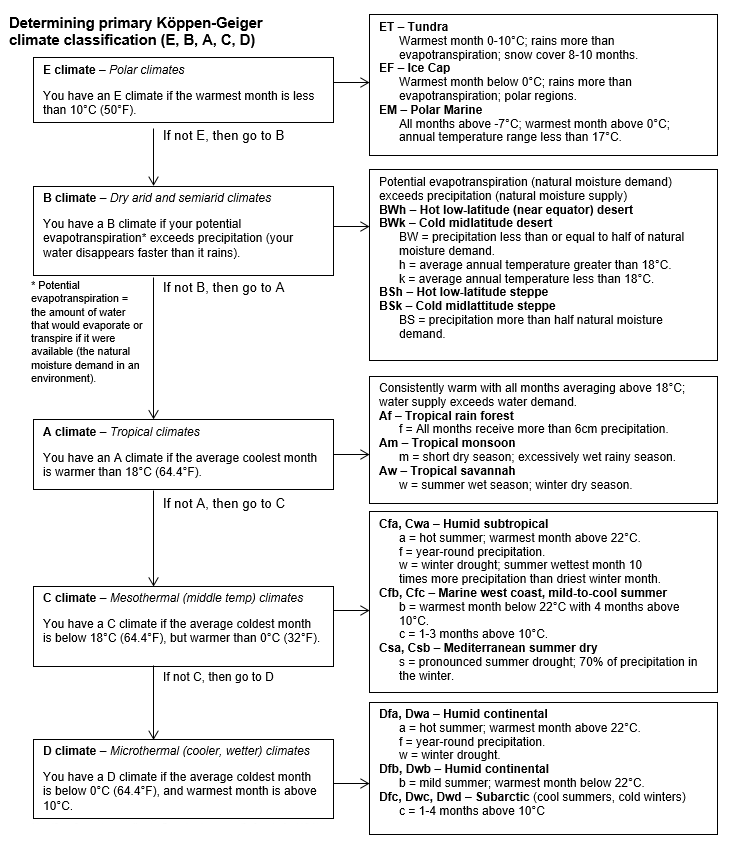
Temperature and precipitation strongly impact types and adaptations of vegetation (as discussed in Abiotic Factors above). One common way of examining worldwide climate zones is the Köppen-Geiger method, which looks at Climate Normals (30 years of data) and assigns codes that represent common climate variables (Figure 11.2).
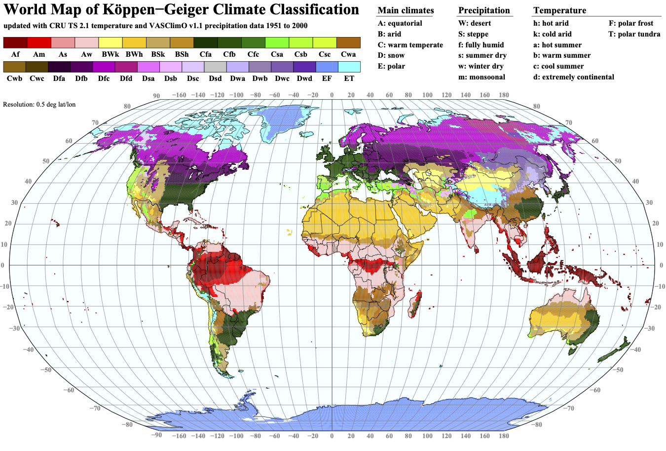
Compare Figure 11.1 and Figure 11.2, and observe that the world’s biomes and climate zones closely correlate. If you would like to explore the Köppen-Geiger system further, see this Resource Library entry from National Geographic introducing the classification system: Köppen Climate Classification System.
Lab Exercises
In this lab you will examine the growth habits and leaf characteristics of nine North American Oak species, and link species distribution across North America to climate and topography.
This lab includes two exercises that result in creating an assignment to be handed in as a report in PDF format. The submitted report will include a series of tables and figures with captions, and text, and should be approximately 5-6 pages long. External references must be cited. The entire lab will take approximately 2 hours to complete.
In EX1 you will use a number of sources to create a summary table and distribution map of nine North American oak species. In EX2 you will explore links between the distribution of species and abiotic factors at the group level.
EX1: Creating a Summary Table and Distribution Map of North American Oak Species
Step 1: Identify Species Characteristics (Table 11.1)
The nine oak species you will investigate in this exercise are listed in Table 11.1 in Worksheets. Open Table 11.1 on your computer or shared drive as directed by your instructor. The table contains links to summary sheets for each oak species. Click on the species names to access.
Use these linked plant fact sheets and the Appendix C to complete the species characteristics in Table 11.1.
Note each species is assigned a letter (A,B,C) and grouped based on geographic location.
Step 2: Identify Climate and Topography (Table 11.1)
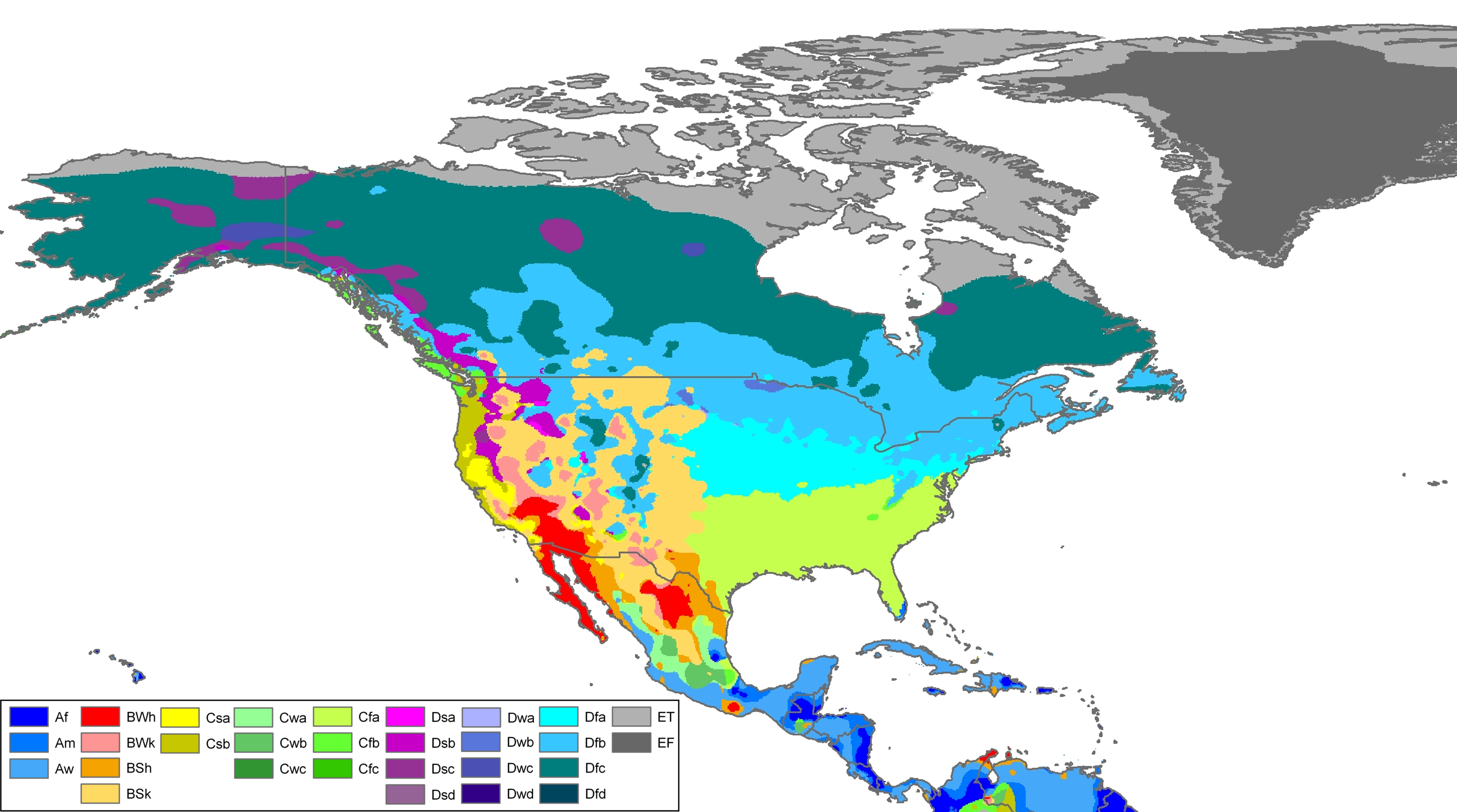
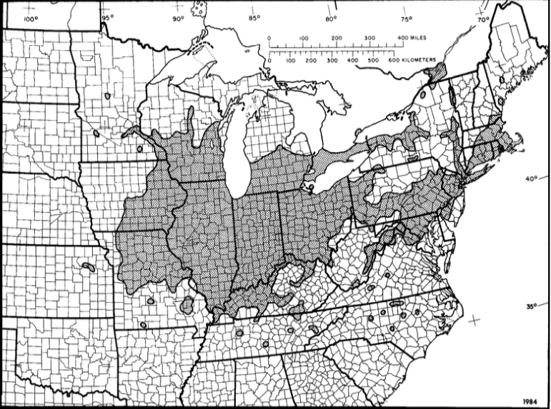
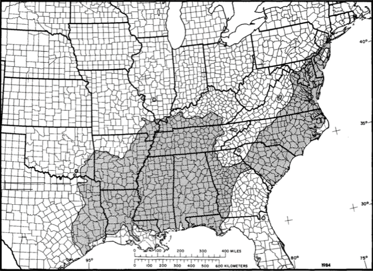
Next, examine the distribution maps in Appendix C to see where each species is currently found. For each species, determine Köppen-Geiger climate code(s) from the map in Appendix A. Rainfall averages and annual temperatures can be found in the summary sheets (or via the Silvics of North America links in Table 11.2 in Appendix C). Interpret the general topography (e.g., mountainous vs lowland) from the map in Appendix B. You can also use this interactive viewer to zoom in on topography by choosing ETOPO1 bedrock dataset.
Record the climate code, average rainfall and temperature, and general topography for each species in Table 11.1.
Step 3: Map the Spatial Distribution of Selected Quercus Species in North America (Map 11.1)
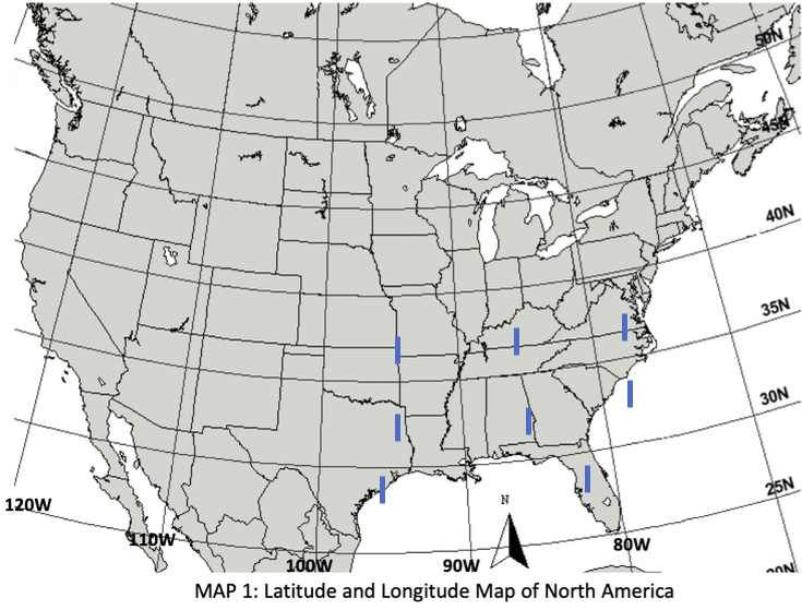
Use the distribution maps in Appendix C to complete Map 11.1 (Worksheets).
Open Map 11.1 on your computer or shared drive as directed by your instructor. You may print out the map, draw your tick marks by hand, and scan/photograph, or use PowerPoint or Word to draw directly on the electronic image.
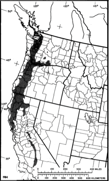
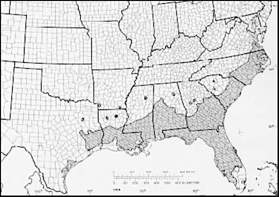
Place a tick mark within each grid box created by the 5 degrees (N-S) latitude and 10 degrees longitude (E-W) lines that cover the same area as each species to demonstrate distribution areas. Use a different colour for each grouping (A, B, C). For example, if your species covers areas of the west coast, put a tick mark in each box along the west coast as appropriate.
Create a legend for your map. Keep in mind that you will need one more colour to answer Reflection Q1, and this will also need to be added to the legend.
Scan, photograph, or save your map at this stage. An example Map 11.1 is found in Figure 11.3.
Step 4: Create the EX1 Portion of Your Report
Open a Word document on your computer, and create a title page for your lab report that includes the title of this lab assignment, your name, lab section, and date.
Create the Exercise 1 portion of your lab report by inserting the title Exercise 1: Summary Table and Map and insert:
- Table 11.1: Summary Characteristics of North American Oak Species.
- Map 11.1: Distribution of Selected Quercus Species in North America.
Add descriptive captions to each item to complete this portion of the report.
EX2: Linking Species Distribution and Abiotic Factors at the Group Level
Based on Map 11.1 and the groupings in Table 11.1 (A,B,C), briefly describe the grouping’s general North American location and list which species are included. For each grouping, include information on
- Representative climate – the climate code and temperature and precipitation. If you have more than one representative climate type, describe what it is and why.
- Representative topography. If you have more than one representative topography, describe what it is and why.
- Species adaptations of tree/shrub characteristics (e.g., growth habit, height, evergreen versus deciduous, leaves) and critically think about some reasons you are seeing these types of species adaptations within a geographic area, based on their abiotic conditions (see Abiotic Factors).
- Other factors that could be important for each grouping’s adaptations that we aren’t considering in this lab. See Abiotic Factors for some ideas. As a geographer, how would you go about researching those links? What datasets would you look for?
Be sure to establish a link between climate, topography and species adaptations for full marks. Organize your discussion per grouping, with a subheading listing the group letter and general North American location before each summary. Limit each grouping summary to 300 words (approximately 2-3 paragraphs).
Create a new section of your lab report titled EX2: Linking Species Distribution and Abiotic Factors at the Group Level and type in your answers.
Reflection Questions
- Choose one (1) additional Quercus species that has not been examined in this lab from Silvics of North America, Volume 2 (scroll to Quercus).
- State your species and why you chose it.
- Add additional tick marks in a different colour for your species distribution on Map 11.1, and update your legend.
- Describe, in 1-2 paragraphs, the tree habit, height, leaf characteristics, climate and topography. Note that you might have to search on the web for additional information, like leaf characteristics. Be sure to include citations on any external sources you use.
- Discuss, in 1-2 paragraphs, how abiotic conditions (temperature, precipitation and topography) could have influenced your tree’s adaptations (height, leaf characteristics, etc). Assign your species to a group from the table above (A, B or C) based on their location and characteristics, or if you decide it should be a new category, explain why. Discuss how your chosen species is similar or different to the previously examined grouping(s) and speculate as to why.
- Demonstrate critical thinking and your understanding of how abiotic conditions can influence tree growth.
- As you examined fact sheets about oak species, you probably noticed unique vocabulary words in the descriptions. List and define five (5) new vocabulary words you encountered during this exercise.
Create a new section of your lab report titled Reflection Questions and type in your answers. Scan or photograph your revised Map 11.1 and include as you response to Q1b.
Report Submission
Once all exercises are complete, save the assignment as a PDF. Do a final check to make sure your maps are clear and that all external references are cited. Submit as directed by your instructor.
Worksheets
Supporting Material
Appendix A: Köppen-Geiger Climate Map of North America
Appendix B: North American Topographic Map
Appendix C: North American Oak Species Characteristic Fact Sheets
| Species | USDA NRCS Fact Sheet | Silvics of North America | Leaf Shape | Distribution Map |
|---|---|---|---|---|
| Quercus bicolor | QUBI [PDF] | Swamp White Oak | Figure 11.6 | Figure 11.7 |
| Quercus chrysolepis | QUCH2 [PDF] | Canyon Live Oak | Figure 11.8 | Figure 11.9 |
| Quercus douglasii | QUDO [PDF] | Blue Oak | Q douglasii | Figure 11.10 |
| Quercus garryana | QUGA4 | Oregon White Oak | Figure 11.11 | Figure 11.12 |
| Quercus laurifolia | QULA3 | Laurel Oak | Figure 11.13 | Figure 11.14 |
| Quercus macrocarpa | QUMA2 [PDF] | Bur Oak | Figure 11.15 | Figure 11.16 |
| Quercus phellos | QUPH [PDF] | Willow Oak | Figure 11.17 | Figure 11.18 |
| Quercus rubra | QURU [PDF] | Northern Red Oak | Figure 11.19 | Figure 11.20 |
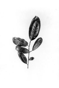
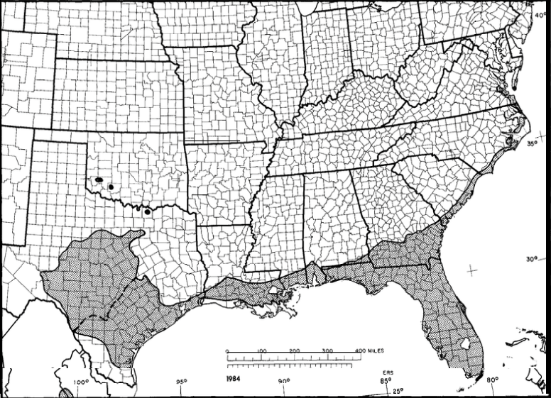
| Quercus virginiana | QUVI [PDF] | Live Oak | Figure 11.21 | Figure 11.22 |
Quercus bicolor
Quercus chrysolepis
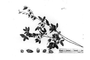
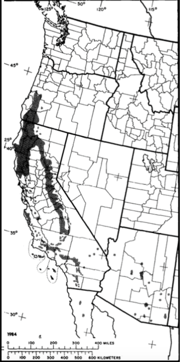
Quercus douglasii
Q douglasii [illustration]
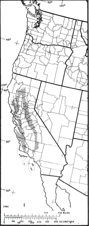
Quercus garryana
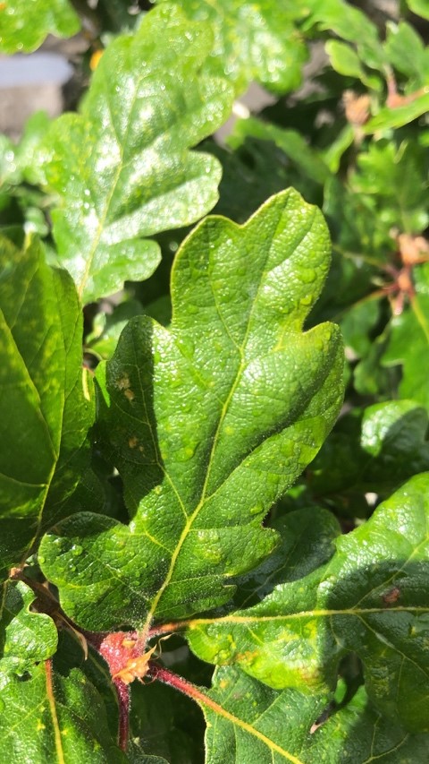
Quercus laurifolia
Quercus macrocarpa
Quercus phellos
Quercus rubra
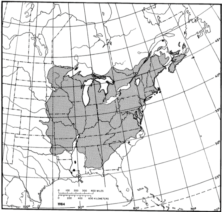
Quercus virginiana
References
Christopherson, R.W. et al., (2019). Geosystems: An introduction to physical geography (4th ed). Pearson Canada Inc.
National Geographic Resource Library. (2020). Koppen climate classification system. National Geographic. https://www.nationalgeographic.org/encyclopedia/koppen-climate-classification-system/
Pellatt, M.G., Gedalof, Z. (2014). Environmental change in Garry oak (Quercus garryana) ecosystems: the evolution of an eco-cultural landscape. Biodiversity and Conservation, 23, 2053–2067. https://doi.org/10.1007/s10531-014-0703-9
UC Museum of Paleontology (2019) The world’s biomes. https://ucmp.berkeley.edu/exhibits/biomes/index.php
United States Department of Agriculture: Natural Resources Conservation Service, (n.d.). PLANTS database. https://plants.usda.gov/home
United States Department of Agriculture. (1990) Volume 2: Hardwoods. Silvics of North America. pp. 605-753. https://www.srs.fs.usda.gov/pubs/misc/ag_654/volume_2/vol2_table_of_contents.htm
Media Attributions
- Figure 11.1: Biomes of the World – Retouched by Terpsichores is licensed under a CC BY-SA 3.0 licence.
- Figure 11.2: Image by Kottek, M., J. Grieser, C. Beck, B. Rudolf, and F. Rubel, 2006: World Map of the Köppen-Geiger climate classification updated [PDF]. Meteorol. Z., 15, 259-263.
- Figure 11.3: Base map by Journey North is licensed under a CC BY-NC-SA 4.0 licence.
- Figure 11.4a: Image by Peel, Finlayson, & McMahon (2007) licensed under a <a class=”internal” href=”https://creativecommons.org/licenses/by-nc-sa/4.0/”>CC BY-NC-SA 4.0 licence.
- Figure 11.4b: Image by G. Krezoski adapted from Christopherson (2019) Appendix C.
- Figure 11.5: Image by S. Peirce is licensed under a CC BY 4.0 licence. Data source: ESRI, NOAA, NGDC (2020).
- Figure 11.6: W.D. Brush, USDA Forest Service. Provided By National Agricultural Library, USDA-NRCS PLANTS Database.
- Figure 11.7: Image by U.S. Department of Agriculture is in the public domain.
- Figure 11.8: Fred E. Dunham, USDA Forest Service, 1938. Provided By National Agricultural Library, USDA-NRCS PLANTS Database.
- Figure 11.9: Image by U.S. Department of Agriculture is in the public domain.
- Figure 11.10: Image by U.S. Department of Agriculture is in the public domain.
- Figure 11.11: Image by G. Krezoski (2021).
- Figure 11.12: Image by the U.S. Department of Agriculture is in the public domain.
- Figure 11.13: Image by W.D. Brush, USDA Forest Service. Provided By National Agricultural Library, USDA-NRCS PLANTS Database.
- Figure 11.14: Image by the U.S. Department of Agriculture is in the public domain.
- Figure 11.15: W.D. Brush, USDA Forest Service. Provided By National Agricultural Library, USDA-NRCS PLANTS Database.
- Figure 11.16: Image by the U.S. Department of Agriculture is in the public domain.
- Figure 11.17: W.D. Brush, USDA Forest Service. Provided By National Agricultural Library, USDA-NRCS PLANTS Database.
- Figure 11.18: Image by the U.S. Department of Agriculture is in the public domain.
- Figure 11.19: W.D. Brush, USDA Forest Service. Provided By National Agricultural Library, USDA-NRCS PLANTS Database.
- Figure 11.20: Image by the U.S. Department of Agriculture is in the public domain.
- Figure 11.21: W.D. Brush, USDA Forest Service. Provided By National Agricultural Library, USDA-NRCS PLANTS Database.
- Figure 11.22: Image by the U.S. Department of Agriculture is in the public domain.
Image Descriptions
Figure 11.1 Biomes of the world.
A world map showing the different types of biomes:
- Tundra
- Taiga
- Montane grasslands and shrublands
- Temperate coniferous forest
- Temperate broadleaf and mixed forests
- Temperate grasslands, savannas, and shrublands
- Tropical and subtropical moist broadleaf forests
- Tropical and subtropical dry broadleaf forests
- Tropical and subtropical grasslands, savannas, and shrublands
- Mediterranean forests, woodlands, and scrub
- Deserts and xeric shrublands
- Flooded grasslands and savannas
- Mangroves

