Chapter 10 Plate Tectonics
10.1 Alfred Wegener — the Father of Plate Tectonics
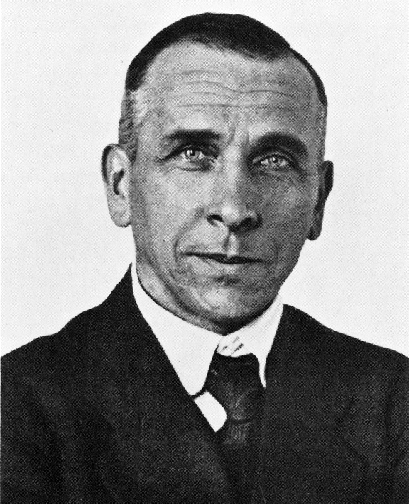
Alfred Wegener (1880-1930) (Figure 10.1) earned a PhD in astronomy at the University of Berlin in 1904, but he had always been interested in geophysics and meteorology and spent most of his academic career working in meteorology. In 1911 he happened on a scientific publication that included a description of the existence of matching Permian-aged terrestrial fossils in various parts of South America, Africa, India, Antarctica, and Australia (Figure 10.2).
Wegener concluded that this distribution of fossils could only exist if these continents were joined together during the Permian, and he coined the term Pangea (“all land”) for the supercontinent that he thought included all of the present-day continents.
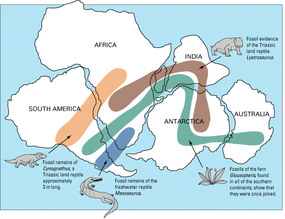
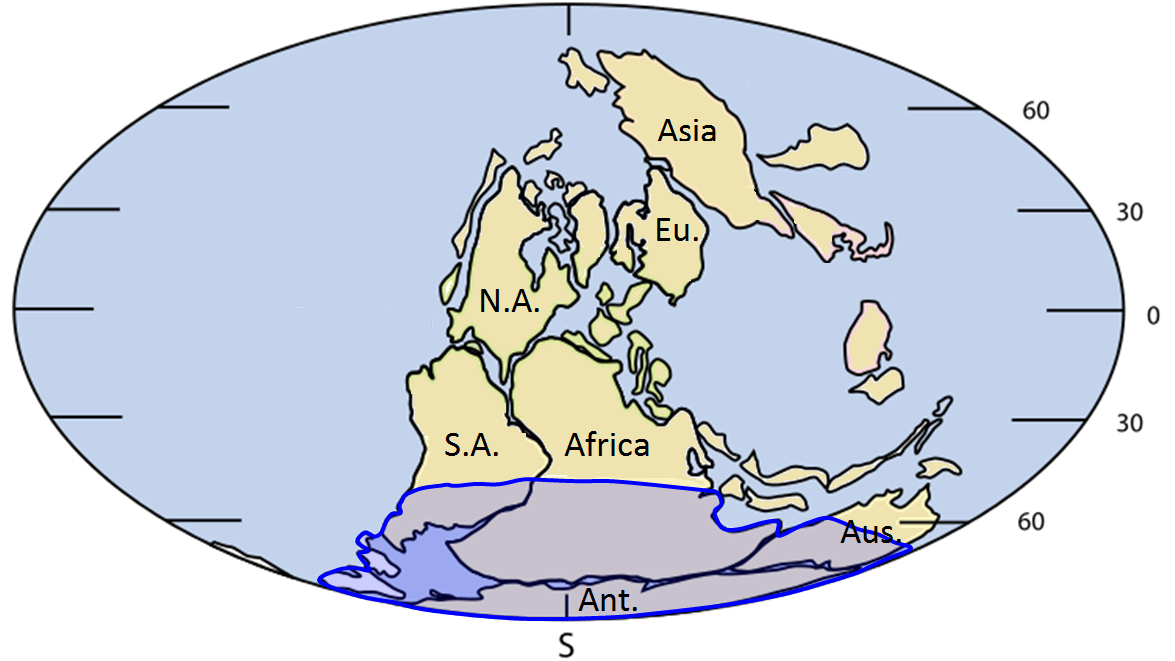
Wegener pursued his theory with determination — combing the libraries, consulting with colleagues, and making observations — looking for evidence to support it. He relied heavily on matching geological patterns across oceans, such as sedimentary strata in South America matching those in Africa (Figure 10.3), North American coalfields matching those in Europe, and the mountains of Atlantic Canada matching those of northern Britain — both in morphology and rock type. Wegener also referred to the evidence for the Carboniferous and Permian (~300 Ma) Karoo Glaciation in South America, Africa, India, Antarctica, and Australia (Figure 10.4). He argued that this could only have happened if these continents were once all connected as a single supercontinent. He also cited evidence (based on his own astronomical observations) that showed that the continents were moving with respect to each other, and determined a separation rate between Greenland and Scandinavia of 11 m per year, although he admitted that the measurements were not accurate. In fact they weren’t even close — the separation rate is actually about 2.5 cm per year!

Wegener first published his ideas in 1912 in a short book called Die Entstehung der Kontinente (The Origin of Continents), and then in 1915 in Die Entstehung der Kontinente und Ozeane (The Origin of Continents and Oceans). He revised this book several times up to 1929. It was translated into French, English, Spanish, and Russian in 1924.
In fact the continental fits were not perfect and the geological matchups were not always consistent, but the most serious problem of all was that Wegener could not conceive of a good mechanism for moving the continents around. It was understood by this time that the continents were primarily composed of sialic material (SIAL: silicon and aluminum dominated), and that the ocean floors were primarily simatic (SIMA: silicon and magnesium dominated). Wegener proposed that the continents were like icebergs floating on the heavier SIMA crust, but the only forces that he could invoke to propel continents around were poleflucht, the effect of Earth’s rotation pushing objects toward the equator, and the lunar and solar tidal forces, which tend to push objects toward the west. It was quickly shown that these forces were far too weak to move continents, and without any reasonable mechanism to make it work, Wegener’s theory was quickly dismissed by most geologists of the day.
Alfred Wegener died in Greenland in 1930 while carrying out studies related to glaciation and climate. At the time of his death, his ideas were tentatively accepted by only a small minority of geologists, and soundly rejected by most. However, within a few decades that was all to change. For more about his extremely important contributions to Earth science, visit this NASA website: http://earthobservatory.nasa.gov/Library/Giants/Wegener/
